
Everglades Depth Estimation Network (EDEN) for Support of Biological and Ecological Assessments
WCA1 | WCA2 | WCA3 | Big Cypress National Preserve | Everglades National Park | Pennsuco Wetlands | Coast of Florida Bay | Coast of Gulf of Mexico
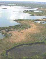
| Pennsuco Wetlands Sub-Area Map |
|---|
 Real time Real time  Non-real time Non-real time  Discontinued Discontinued
|
|
Leaflet Map showing EDEN sub-areas. This map requires enabled JavaScript to view; if you cannot fully access the information on this page, please contact EDEN Data Help. References to non-U.S. Department of the Interior (DOI) products do not constitute an endorsement by the DOI. |
To view a station, click on the icon above. Please note: Not all stations may be viewable from this zoom level. Use the zoom tool, located in the upper-left corner of the map to zoom in or out.
| Pennsuco Wetlands EDEN Station Listing |
|---|
| G-1488 |
| G-3567 |
| G-3676 |
| G-3761 |
| G-3818 |
| G-975 |
| G119_H |
| G119_T |
| NWWF |
| S380_H |