
Everglades Depth Estimation Network (EDEN) for Support of Biological and Ecological Assessments
[ Station Information | Data Links | Datum Information | Ground Elevation/Vegetation | Other Information ]
| Station Information | |
|---|---|
| EDEN Station Name: | L28_GAP |
| Operating Agency: | SFWMD |
| Latitude (DMS) NAD83: | 26°07'28" |
| Longitude (DMS) NAD83: | -80°59'00" |
| UTM Easting Zone 17N (meters NAD83): | 501659.4 |
| UTM Northing Zone 17N (meters NAD83): | 2889475.3 |
| Location Area: | Big Cypress National Preserve |
| Real-time data (daily): | Yes |
| Data Links |
|---|
[Information about these links] |
Available parameters: (from EVE website)
|
| Other Database Links(Data on SFWMD DBHYDRO is in NGVD29) |
| Datum Information | |
|---|---|
| Vertical Datum for Water Level Data: | NAVD88 |
| Vertical Conversion at Gage (ft) used by EDEN (NGVD29 to NAVD88): | -1.42 |
| Help | |
| Why are all gage data not referenced to the same datum? | |
| How do I convert data at a gage from one datum to another? | |
| How were the vertical conversions at gages determined by EDEN? | |
| Ground Elevation and Vegetation Information for L28_GAP | |
|---|---|
| [How was this collected?] | |
| Major Vegetation Community | |
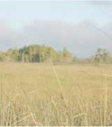
| Vegetation Community: | Slough or open water |
| Average Ground Elevation (ft) NAVD88: | 10.12 |
| Maximum Ground Elevation (ft) NAVD88: | 10.21 |
| Minimum Ground Elevation (ft) NAVD88: | 9.80 |
| Number of Measurements: | 6 |
| Collecting Agency and Date: | USGS, July 2007 |
| Secondary Vegetation Community | |
| Vegetation Community: | Wet prairie |
| Average Ground Elevation (ft) NAVD88: | N/A |
| Maximum Ground Elevation (ft) NAVD88: | N/A |
| Minimum Ground Elevation (ft) NAVD88: | N/A |
| Number of Measurements: | N/A |
| Collecting Agency and Date: | USGS, July 2007 |
| Other Information | |
|---|---|
| Type of Station (Physical Location): | Marsh |
| Type of Station (Freshwater/Tidal): | Freshwater |
| Leaflet Map | |
|
Leaflet Map (showing location of gage L28_GAP). This map requires enabled JavaScript to view; if you cannot fully access the information on this page, please contact Bryan McCloskey References to non-U.S. Department of the Interior (DOI) products do not constitute an endorsement by the DOI. |
|